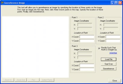
This is a standalone tool to allow an image or raster data file to be given a spatial location for use in mapping software. This is done by clicking three points on the image and providing the real-world coordinates for those points. The image can optionally be rectified such that north is straight up. The appropriate world file will then be written. The image display and manipulation functionality comes from MapWinGIS.
The developer changed the name of the software from Georeferencing Tool to Image Georeferencer
Comments